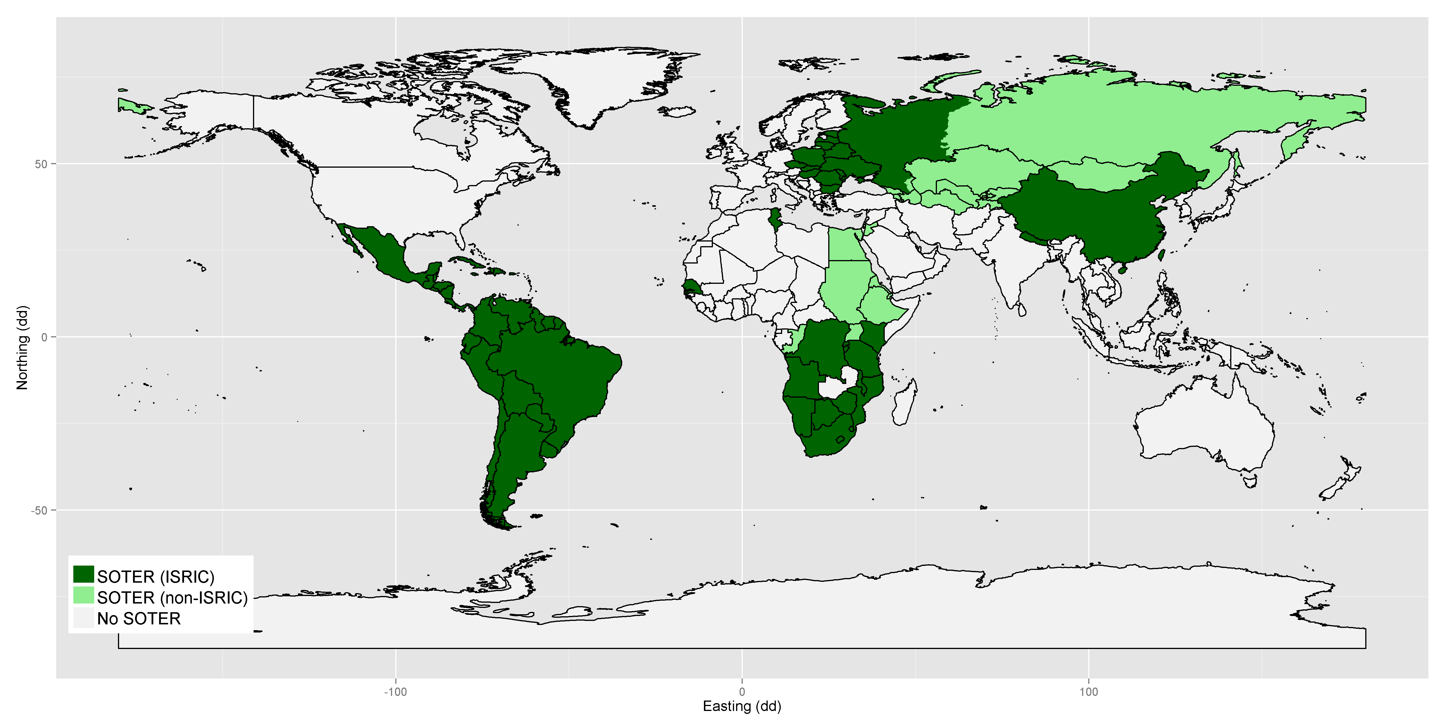

The SOTER programme was initiated in 1986 by the Food and Agricultural Organization of the United Nations (FAO), the United Nations Environmental Programme and ISRIC, under the auspices of the International Soil Science Society. The aim of the programme was to develop a global SOTER database at scale 1:1 million that was supposed to be the successor of the FAO-UNESCO Soil Map of the World. A SOTER database with global coverage was never achieved, but SOTER databases were developed for various regions, countries and continents. Typically, SOTER databases are developed in collaboration with a range of partners.
A SOTER database is composed of a map (in GIS polygon format) that delineates the SOTER map units and a set of tables in a relational database (in MS Access or PostGreSQL format) with terrain and soil data. The information in the table can be linked to the units of the map.