
In its capacity as reference and information centre, ISRIC is the custodian of the World Soil Reference Collection, the World Soil Library of Maps and Reports, ISRIC data collection and various smaller soil collections. In the World Soil Museum these collections are being exhibited, soil education programs are provided, and we raise awareness on the diversity and importance of soil.
Soil collections and education
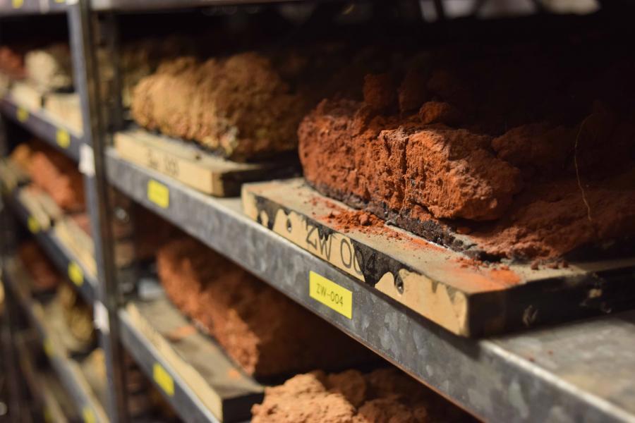
World Soil Reference Collection
The World Soil Reference Collection is a world unique collection. It contains soil monoliths, undisturbed, vertical soil samples of around 1.5 meters deep, all representative examples of the units distinguished in the Soil Map of the World. These reference profiles are well documented and analysed and therewith are a resource for education, correlation and research . The Reference Collection contains around 1,100 soil monoliths from 82 countries, representing a wide range of geographic regions, environments, soil types, soil processes, and human impact on soils. The World Soil Reference Collection data are accessible through the ISRIC Soil Information System. Learn more about the Reference Collection.
World Soil Museum
The World Soil Museum is the stage for the World Soil Reference Collection where we showcase the diversity of soils through interactive exhibitions and guided tours that connect soils and their functions to themes such as land management. The museum offers visitors of all backgrounds and ages a first introduction to the soil, thus actively contributing to increasing soil literacy. It also serves as an educational hub for researchers, students, and policymakers to learn about soils, their properties, functions, management, and sustainability. The museum contributes to global soil awareness by preserving and documenting soil samples from different regions. All these efforts highlight the vital role of soils in ecosystems, agriculture, and climate regulation. Visit the museum or learn more about it.
World Soil Library of Maps and Reports
The World Soil Library of Maps and Reports preserves and safeguards previous, historical and valuable soil surveys, maps, and reports. Today the library houses over 27,000 records of legacy soil information, including 10,000 soil maps, and 17,000 books and reports. Its physical collection is open to the public, with most materials available online. Currently, 70% of maps are accessible in high resolution, and over 35% of reports and books are in PDF format. Access the library.
Data Collection
ISRIC has been collecting, compiling, and harmonising data with its partners for over 60 years. These data are brought together in the ISRIC Data Collection, which is publicly available through the ISRIC Data Hub. The hub also hosts a limited number of third-party datasets that have been evaluated by ISRIC staff. Access the Data Hub.